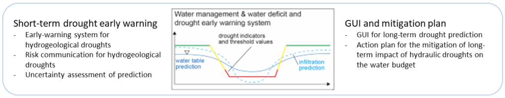
The integration into a web-based toolbox, which includes a drought early warning system and adapted pumping and storage strategies, will enable water users and local authorities to improve regional resilience to extreme climate events and minimise water stress. The output of the product to be developed focus on both early drought warning and long-term forecasting of water shortage situations. The focus is not on the meteorological drought driven by the interaction of precipitation and evaporation, but rather on the resulting occurrence of water scarcity in the aquifers and in particular the dependence of the aquifers on the supply from the very powerful vadose zone. The approaches and models needed are driven on the one hand by short-term weather forecasts and seasonal forecasts, and on the other hand by climate projection data (up to 2070).
The programme system of the Toolbox is designed with regard to data formats, processing structures and programming designed in such a way that, for practical application, fast response times for the processing of large amounts of data can be realised. Here we use the very efficient binary HDF5/netCDF formats in combination with the GDAL Virtual Raster (VRT) in order to hold very large amounts of data and to evaluate them dynamically with short response times via the map server. The netCDF format is a globally used standard for the efficient storage and processing of geoscientific mass data. This format forms the basis for the visualisations via the map server and the processing of data in the backend. As a universal data structure the netCDF format enables the mapping of multidimensional data and images as well as the efficient execution of algorithms in Python/NumPy. The files are stored in a file system and associated references in the database.